


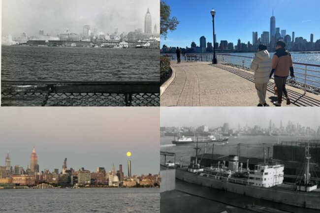
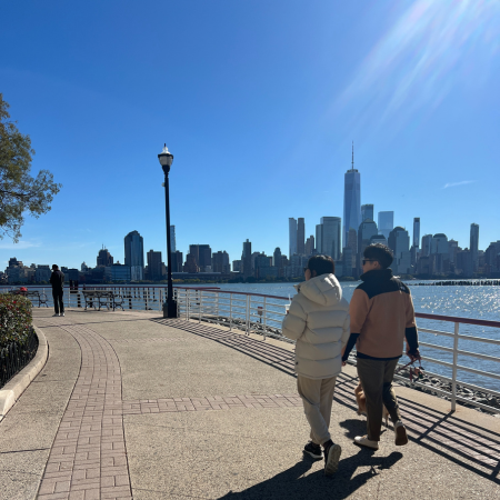
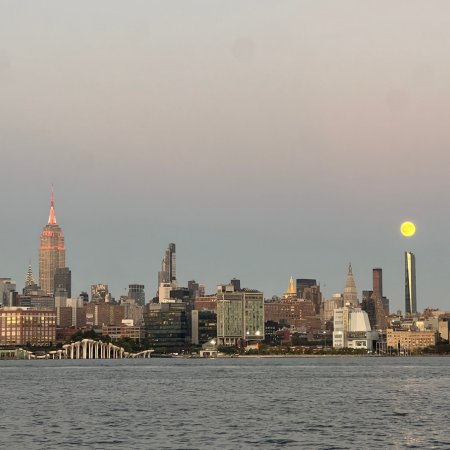
On any given day, runners, commuters, grandparents with strollers, tourists, bikers, and hikers speed through or amble along the spectacular 18.5-mile Hudson River Walkway that lines the western shore of the Hudson. The expansive pathway was established through New Jersey’s Public Trust Doctrine and state requirements for riverfront development, which mandate public access and a continuous path along the waterfront. Now a defining feature of New Jersey’s Hudson River municipalities, this well-used public asset came as a massive improvement to a shoreline that has seen four centuries of dramatic change. Read on to learn about how this beloved trail, touting food, fun, and breathtaking views, came to be.
What the Hudson Walkway is Today
Our Hudson River West pedestrian thoroughfare runs through nine municipalities of Hudson and Bergen counties: Bayonne, Jersey City, Hoboken, Weehawken, West New York, Guttenberg, North Bergen, Edgewater, and Fort Lee. The state planned the walkway to exist immediately adjacent to the river in a continuously connected 16-foot-wide path from the southern tip of Bayonne to the George Washington Bridge. It was built in segments and continues to improve and grow through the advocacy of state and local groups like the Fund for a Better Waterfront. Today, the non-profit Hudson River Waterfront Conservancy exists to monitor the upkeep and accessibility of the path for the public.
Pedestrian and bike-friendly, the long promenade offers a ton of excellent restaurants with sensational views along each stretch. Urban adventurers can take to the water from boating launch sites like the Hoboken Cove Community Boathouse and Urban Paddle in Jersey City.
Though officially the pathway runs 18.5 continuous miles along the Hudson shoreline, it meanders into parks, piers, and plazas to provide well over 20 miles of opportunity for exploration and selfies taken with a backdrop of iconic New York City views. Public access 24/7 is written into the rules of the walkway. Making sure that it stays accessible is an ongoing project that keeps the Conservancy partnered up with the New Jersey Department of Environmental Protection, the local municipalities it cuts through, along with all the many waterfront property owners, and members of the public who wish to join the effort.
Read More: Hoboken’s Historic Role in the Macy’s Thanksgiving Day Parade
From Eden to a Busy, Booming Riverfront
In 1609, Henry Hudson sailed for the Dutch West India Company into the river now named for him and first dropped anchor in what is today the New York & New Jersey Harbor, the estuary that runs from the southern tip of Manhattan to the Atlantic Ocean. His ship, the Half Moon, then stopped in Weehawken Cove. His first mate noted the Cove’s white-green cliff — now known as Castle Point. Henry Hudson and his crew had landed on a shore defined by a diverse ecosystem of forests and extensive tidal wetlands. All around them, saltmarsh cordgrass, cattails, wild rice, wild celery, waterlilies, buttonbush, and goldenrod grew in lush marshland and coastal meadows.


It takes some imagination to picture the Hudson River shoreline as it was before the Lenni Lenape people were forced to contend with European colonialism. Dutch poet Jacob Steendam, who lived in New Netherlands from 1650 to 1660, on what is now Manhattan, described the land along the Hudson River as uniquely beautiful: This is the land, with milk and honey flowing/ With healing herbs like thistles freely growing/ The place where the buds of Aaron’s rods are blowing/ O, this is Eden.

Not long after he penned that verse, a densely populated, thriving commercial riverfront developed on both sides of the southern tip of the Hudson. The Hudson River’s west coast quickly became home to a burgeoning fur trade and a wildly successful oyster industry, along with brick manufacturers and iron producers.
When New Jersey’s Waterfront was All Industry
The Hudson waterfront quickly became a vital point in the US economy. And it stayed that way. Up until the early 20th-century, ships were the only mode of transportation for people and goods to get in and out of Manhattan. Wharves and warehouses along the river swarmed with workers moving cargo. This was a time before bridges and tunnels crossed between New Jersey and New York. Ferries were the only method for the tens of thousands of commuters to shuffle back and forth between Jersey and Manhattan. The docks and railyards were in constant action. The rough lives of the longshoremen and widespread corruption of the shipping industry is memorialized in the 1954 Marlon Brando crime drama, On the Waterfront.
The Hudson River shoreline shifted dramatically and rapidly as commercial industries moved in and out. Among the many companies that built along the riverfront were some edifices with business names that spark nostalgia in longtime residents — like Colgate-Palmolive, Maxwell House, and Lipton Tea — along with those of industrial giants — like Standard Oil, Bethlehem Steel, Ford Motor Company, Lever Brothers (now Unilever), and Archer-Daniels-Midland. These industries often moved away or shut down, leaving bits of their businesses behind. The New Jersey view of the east side of the river in New York was equally ridden with machinery, warehouses, trucks, and railroads. The waste byproducts, water, soil, and air pollution that surrounded these operations did not inspire notions of leisurely strolls along magnificent vistas. By the latter half of the twentieth century, the Hudson shoreline had become an industrial eyesore.
A Matter of Vision
The vision of a New Jersey riverfront that would take advantage of its unparalleled views of New York City’s skyline and celebrate the natural beauty of the Hudson River took shape as the region began to flourish as a financial center. The push to make it happen looked toward the very successful waterfront regulations in New York for precedent. Starting in 1988, Coastal Zone Management Rules created by the New Jersey Department of Environmental Protection mandated that builders erecting anything within 100 feet of the water provide at least 30 feet of public space at the waterfront. This mandate aligns with the NJ Public Trust Doctrine, which established the public’s right to access all tidal waterways and shorelines.
There were many hurdles along the way to building the promenade we have today. A great deal of the walkway’s length is controlled by the Port Authority of New York and New Jersey. Each town along the waterfront has its own zoning rules. Private landowners were provided exceptions to the regulations that made development of the pathway possible. Those corporate and individual owners have not been obligated to provide recreational space for the public until their property is redeveloped, sold, or repurposed. Until then, they are required to provide access to the waterfront, but no more. The process of building and improving upon the expansive riverfront’s public space is a lengthy process, largely due to unpredictable shifts in land use.
Walking through Garden State History
There are markers and signs along the Hudson River Walkway that encourage reflection upon time gone by. Kieft’s War, also known as the Pavonia Massacre, is recalled at a bypass between sections of the walkway in Jersey City at the Newport PATH station. King’s Bluff,
where the Hamilton-Burr duel took place, is located along the Weehawken stretch of the waterfront walkway. Informational signage reports on the use of the waterfront in Jersey City for those working within the Underground Railroad to ferry enslaved Black people toward freedom.
A plaque marks the site of the 1916 Black Tom munitions depot explosion. Walkers can use signs to identify the buildings they see in Manhattan when they look across the water or to name the birds flying overhead.
How to Get There
The walkway is both popular and practical. Even if commuters were totally disinterested in the majestic views, open sky, pretty landscaping, and general loveliness of the walkway, it would still pull in crowds of people every day. Every New Jersey ferry stops along a branch of it. PATH, the Hudson-Bergen light rail, and the NJ Transit bus system all connect various parts of NJ and NY at points along it. Citybike stations dot the path. For those coming in with cars, there are easy access points suggested by the Hudson River Waterfront Conservancy:
Edgewater Commons Shopping Center / 555 New River Road, Edgewater
Edgewater Harbor Shopping Center / 15 Somerset Lane, Edgewater
Port Imperial / 4800 Avenue, Weehawken
River Street / 333 River Street, Hoboken
Exchange Place / Jersey City
Liberty State Park / 200 Morris Pesin Drive, Jersey City
See More: New Jersey Towns with Lenape History: Hoboken, Weehawken, + Beyond
Follow @thehobokengirl on Instagram + TikTok for the latest Hoboken and Jersey City updates, sign up for our weekly newsletter here that shares everything you missed each week, and check out our events calendar, which has over 100+ events weekly to peruse.